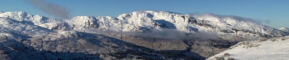
Yes, team, we are having an April training! But in keeping with the critical importance surrounding social distancing we are going to avail ourselves of ‘teleworking’. To that end I have set up a geocaching course out at Termination Point. The purpose of this training is to practice navigation with the Gaia app. Below I will provide the latitude and longitude for 11 Navy Seal course orienteering points. For those of you who have participated in the previous small-teams training we conducted out at Termination Point, some of the locations will be familiar, but many will not. Some reside in parts of the Termination Point forest that very few people visit.
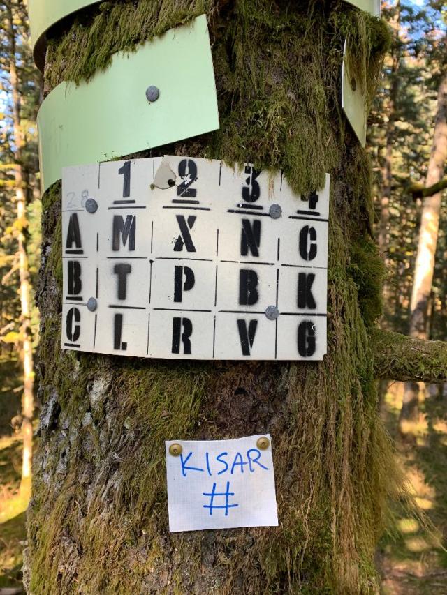
At each of the 11 locations you will find a small Tyvek sign with “KISAR” in blue permanent marker, below which there will be either a letter or number (see the example below where the # will be replaced with an alpha-numeric character). You will need to record this letter or number from each location. After locating all 11 symbols, rearrange them to form a common phrase (yes, it’s a puzzle, but this shouldn’t be too challenging). After you complete these tasks let me know directly via an email to: tscheezy AT yahoo DOT com (don’t reply to kisar emails which go to everyone). Every KISAR member who completes this training by the end of April wins a sew-on KISAR patch (yay, prizes!).
This is a pretty challenging course complete with swamps, devil’s club and salmonberry patches, dense forest and windfall. I know the area well and it took me over 3 hours and I traveled 6.6 miles setting up the course. You should assume it will take you longer, so don’t wait until the afternoon to get started. I HIGHLY recommend you record your track in Gaia because it forces your phone to update your location constantly. If you don’t record, your phone may take a long time to acquire your location again in the dense trees. If you need to bone up on your Gaia skills, this is a very comprehensive tutorial: Gaia GPS Tutorial. The main thing you will need to be able to do is create a new waypoint, and then change the latitude and longitude values to move that waypoint to the correct location. You can enter these at home before heading out. Here are the 11 locations:
1. 57.84131, -152.42726
2. 57.84168, -152.42127
3. 57.84677, -152.41010
4. 57.84824, -152.41483
5. 57.85127, -152.42423
6. 57.86077, -152.43079
7. 57.86126, -152.43293
8. 57.86121, -152.42729
9. 57.86089, -152.42525
10. 57.85168, -152.42930
11. 57.84811, -152.42653
Please note that the free version of Gaia does not offer the use of cached maps for offline use, and part of this course does not have cell coverage. Keep that in mind before you head out. Gaia is an excellent app and essential for the work we do. Consider getting the basic paid version ($17 per year or $60 for 5 years at gaiagps.com). Other good quality GPS apps are available for free or low cost like ViewRanger.
Treat this like a real training and bring a well-provisioned pack with communication resources (at least half the course has no cell coverage), cell phone battery backup, food & water, clothing, first aid & safety gear, and maybe even a light shelter and stove. The Coastal Trail is in good shape with very little snow or ice, but the inland trails are very icy. Microspikes (or similar) are mandatory and I highly recommend trekking poles. The forest is littered with deer carcasses and those deer which are still alive are very weak, so keep that in mind if you bring your pet. I have seen no bear sign but take the normal precautions. For safety reasons I recommend doing this in pairs so if there is someone you feel safe going with (you have been in quarantine with them) proceed as normal. If you go with another person that you have not been in quarantine with, please drive out in separate cars and travel together but stay appropriately physically distanced during the day. If someone really wants to do this training but can’t find a partner, send me an email and I would be happy to tag along. If you have any questions, don’t hesitate to email me (tscheezy AT yahoo DOT com).
In order to comply with the training safety plan I submitted to the State Troopers, all members (or one representative from each group) participating in this activity need to send an email to me, Nick, and Steve before you deploy to Termination Point and a second one after you return to town. The first email announcing your intention to do the course can be anytime prior to heading out and should state your estimated time out conducting the training, but the followup email when you return to town should be sent asap so that we know you are back safely. I appreciate everyone following these simple sign-in / sign-out measures.
Have fun and be safe!
Philip